


-
Vendor:Hema
Victoria's Deserts 4WD Map
Victoria's Deserts 4WD Map (5th Edition) Covering the Mallee and northern Wimmera districts of Victoria and far eastern South Australia, this map is aimed fairly and squarely at the 4WD market and covers an area that has little commercial map coverage. Known for its...- $14.95
- $14.95
- Unit price
- per
-
Vendor:Hema
Tallarook Forest Activities Map
Tallarook is set on the northern slopes of the Great Dividing Range in Victoria. Tallarook State forest comprises 5,100 ha of mixed species Eucalypt forest. Tallarook State forest provides excellent opportunities for recreational four-wheel-driving, camping, bushwalking, mountain bike riding, horse riding and trail bike...- $6.00
- $6.00
- Unit price
- per
-
Vendor:Hema
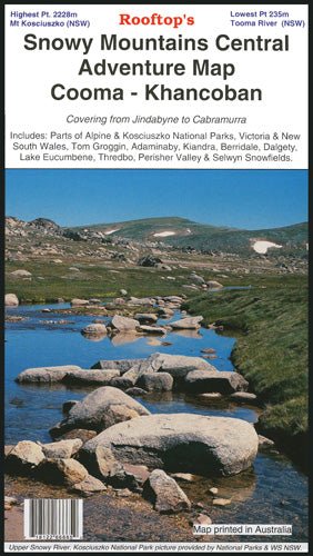
Snowy Mountains Central, Cooma, Khancoban Map
A double-sided map that covers from Jindabyne to Cabramurra, including parts of the Alpine and Kosciuszko National Parks, Victoria and New South Wales, Tom Groggin, Adaminaby, Kiandra, Berridale, Dalgety, Lake Eucumbene, Thredbo, Perisher Valley and Selwyn Snowfields on one side, and the other being...- $14.95
- $14.95
- Unit price
- per
-
Vendor:Hema
Marysville - Lake Eildon Adventure Map
Discover the captivating landscapes of Victoria’s High Country with the Rooftop Maps ‘Marysville - Lake Eildon Adventure Map’. This double-sided map is your gateway to a world of outdoor exploration, covering Lake Eildon, the Yarra Ranges National Parks, and an array of remarkable destinations...- $14.95
- $14.95
- Unit price
- per
-
Vendor:Hema
The Victorian High Country - South Eastern Map
This map is part of Hema's new Victorian High Country Map Series and covers the Southern Lowlands and Lakes Areas. It overlooks Gippsland, Howqua, Jamieson, Licola, Maffra, Lawson, Walhalla, Woods Point and Alpine, Snowy River and Mitchell National Parks. Printed on durable waterproof paper,...- $15.95
- $15.95
- Unit price
- per
-
Vendor:Hema
The Victorian High Country - North Western Map
This map is part of Hema's new Victorian High Country Map Series and covers the North-Western Alps Area. It overlooks Hotham, Wangaratta and surrounds including Bright, Bogong, Mount Buffalo, Dinner Plain and Falls Creek along with hundreds of 4WD tracks set among spectacular alpine...- $15.95
- $15.95
- Unit price
- per
-
Vendor:Hema
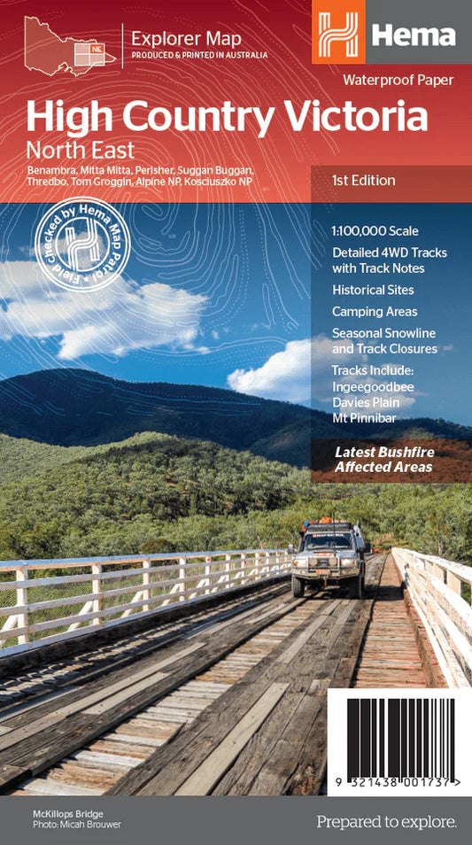
The Victorian High Country - North Eastern Map
This map is part of Hema's new Victorian High Country Map Series and covers the Northern Borderlands Area. It overlooks the ranges that border Victoria and New South Wales from Omeo to Jindabyne, including such destinations as Benabra, Perisher, Tom Groggin, Thredbo, and Kosciuszko...- $15.95
- $15.95
- Unit price
- per
-
Vendor:Hema
Gippsland Lakes - Ninety Mile Beach Map
A map that covers from Lakes Entrance to Heyfield, including Bairnsdale, Loch Sport, Maffra, Metung, Paynesville, Sale, Seaspray, Golden Beach, The Lakes National Park, Mullundung Forest and Holey Plains SP.- $14.95
- $14.95
- Unit price
- per
-
Vendor:Hema
Cohuna - Echuca - Gunbower Map
A double-sided map that covers many locations around the Murray River region, including Gunbower Island, Perricoota, Koondrook, Guttrum, Benwell Island, Campbell Island, as well as the Werai State Forest Map.- $11.95
- $11.95
- Unit price
- per
-
Vendor:Hema
Bright - Mansfield Adventure Map
Uncover the stunning landscapes of the Victorian wilderness with Rooftop Maps ‘Bright - Mansfield Adventure Map’. This comprehensive map provides an in-depth view of the region, covering the captivating Wonnangatta Approaches, the breathtaking Mt Buffalo Plateau, and the pristine Alpine National Parks. It's your...- $15.95
- $15.95
- Unit price
- per
-
Vendor:Hema
Bright - Dartmouth Map
A double-sided waterproof map that includes: Omeo Victoria Falls Falls Creek Harrietville Bright Mt Beauty Dinner Plain Benambra Mitta Mitta Bogong High Plains Dartmouth Dam Alpine National Park In addition to the topographical mapping, there are 37 images of bush huts around Bright, Omeo...- $14.95
- $14.95
- Unit price
- per
-
Vendor:Hema
Big River - Rubicon - Woods Point Map
A forest activities map that has mapping at both 1:50,000 and 1:100,000 that covers as far as Mt Skene.This map also includes: Notes Places of interest Ideal for outdoor recreational activities Waterproof paper This double-sided map includes Big River, Woods Point, Big River Arm of Lake...- $14.95
- $14.95
- Unit price
- per
-
Vendor:Hema
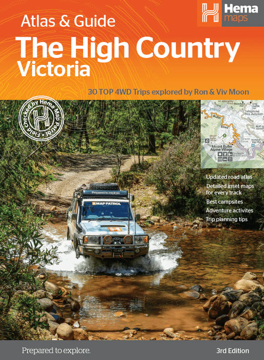
The Victorian High Country Atlas & Guide
The definitive guidebook for discovering the Victorian High Country, featuring the Top 30 4WD Trips written by Ron and Viv Moon, in combination with topographic atlas mapping for the region. This edition of Hema’s best-selling outdoor guidebook for discovering the Victorian High Country now...- $49.95
- $49.95
- Unit price
- per