


-
Vendor:Hema
4WD + Camping Escapes South East Queensland - Atlas
This guide from Hema outlines the best four-wheel driving and camping locations in the picturesque South East Queensland featuring: Brisbane & Moreton Bay Islands Sunshine Coast Hinterland & South Burnett Cooloola Coast Main Range & South West Each regional section outlines the area’s 4WD Tracks...- $29.95
- $29.95
- Unit price
- per
-
Vendor:Hema
4WD Adventures - Atlas
Discover Australia’s Top 100 4WD tracks using this guide as your ultimate off-road adventure tool. Each page features colourful, glossy imagery and detailed tracks personally mapped out and driven by the Hema Map Patrol and our team of experts, for the most up-to-date information...- $69.95
- $69.95
- Unit price
- per
-
Vendor:Hema
4WD Treks Close to Melbourne - Atlas
Fully updated and field checked by the Range Rover Club of Victoria, this fourth edition of 4WD Treks Close to Melbourne will take you on 20 of the best 4WD adventures within a couple of hours drive of the city.Whether you are looking for...- $49.99
- $49.99
- Unit price
- per
-
Vendor:Hema
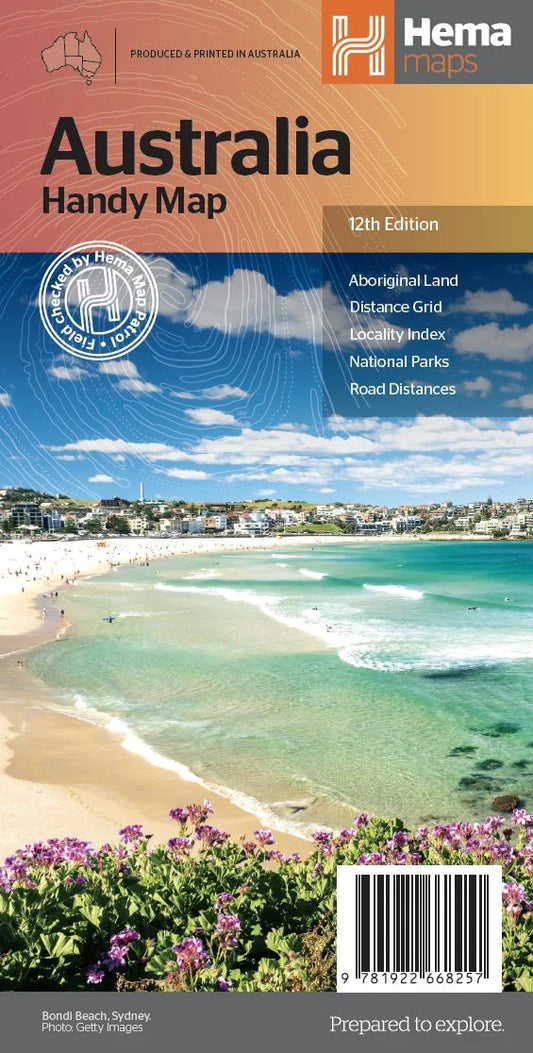
Australia Handy Map
The Australia Handy Map is a foldable, compact Australian map that is perfect as a journey planner or reference tool. It shows national parks and major road networks with distances for planning, along with major city CBD maps for Brisbane, Melbourne, Sydney, Canberra, Darwin, Adelaide, Perth and Hobart on the reverse side, as well as a...- $11.95
- $11.95
- Unit price
- per
-
Vendor:Hema
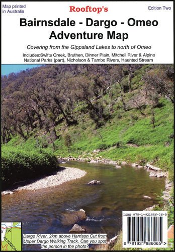
Bairnsdale - Dargo - Omeo Map
A double-sided map that includes Paynesville, Metung and Lakes Entrance in the south to Dinner Plain, Omeo and Mount Nugong in the north. It features Dargo, Mitchell River National Park, Swifts Creek, Cobungra, Victoria Falls, Cassilis, Deptford, Bullumwaal, Mount Baldhead, and Haunted Stream.- $14.95
- $14.95
- Unit price
- per
-
Vendor:Hema
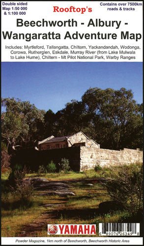
Beechworth - Albury - Wangaratta Adventure Map
A double-sided map that includes Albury, Beechworth, Wodonga, Wangaratta, Rutherglen, Chiltern, Myrtleford, Tallangatta, Dederang, Yackandandah and Eskdale while the other side includes Beechworth Forest Activities covering Beechworth, Chiltern, Wodonga, Myrtleford and Yackandandah.- $12.95
- $12.95
- Unit price
- per
-
Vendor:Hema
Benalla - Mansfield - Strathbogie Ranges Map
A double-sided map; on one side is the Adventure Map side (1:100 000 no contours) and includes the popular camping areas along the Goulburn River around Murchison. It also now includes most of the Winton Wetlands Forest Activities. On the other side is the Forest...- $14.95
- $14.95
- Unit price
- per
-
Vendor:Hema
Big River - Rubicon - Woods Point Map
A forest activities map that has mapping at both 1:50,000 and 1:100,000 that covers as far as Mt Skene.This map also includes: Notes Places of interest Ideal for outdoor recreational activities Waterproof paper This double-sided map includes Big River, Woods Point, Big River Arm of Lake...- $14.95
- $14.95
- Unit price
- per
-
Vendor:Hema
Birdsville & Strzelecki Tracks Map
Explore the stunning landscapes and attractions of the Birdsville and Strzelecki tracks with the Birdsville & Strzelecki Tracks Map from Westprint Maps. This magnificent area of outback Australia stretches from Betoota in the north, through Birdsville, and south to Marree. The map also covers...- $14.95
- $14.95
- Unit price
- per
-
Vendor:Hema
Bright - Dartmouth Map
A double-sided waterproof map that includes: Omeo Victoria Falls Falls Creek Harrietville Bright Mt Beauty Dinner Plain Benambra Mitta Mitta Bogong High Plains Dartmouth Dam Alpine National Park In addition to the topographical mapping, there are 37 images of bush huts around Bright, Omeo...- $14.95
- $14.95
- Unit price
- per
-
Vendor:Hema
Bright - Mansfield Adventure Map
Uncover the stunning landscapes of the Victorian wilderness with Rooftop Maps ‘Bright - Mansfield Adventure Map’. This comprehensive map provides an in-depth view of the region, covering the captivating Wonnangatta Approaches, the breathtaking Mt Buffalo Plateau, and the pristine Alpine National Parks. It's your...- $15.95
- $15.95
- Unit price
- per
-
Vendor:Hema
Camping Guide to South Australia
Experience the very best camping destinations in South Australia with this full-colour, fully updated and detailed directory to over 400 campsites. With Camping Guide to South Australia, 4th Edition, you'll find a comprehensive listing of more than 120 parks, forests and reserves where you can...- $34.99
- $34.99
- Unit price
- per
-
Vendor:Hema
Camping Guide to Tasmania
The perfect guidebook to over 180 sites throughout Tasmania in more than 50 parks, forests and reserves. The newest edition contains 5 regional and 12 park and reserve maps. Over 180 campsites Full state-wide coverage Detailed information on campsite access and facilities Includes reserve, regional...- $34.99
- $34.99
- Unit price
- per
-
Vendor:Hema
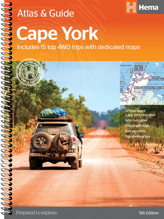
Cape York Atlas & Guide
Hema Maps’ Cape York Atlas & Guide helps you make the most of your visit to this remarkable part of Australia. With detailed coverage of The Tip, the coast from Cairns to Cooktown, Rinyirru (Lakefield) National Park, the Peninsula Developmental Road, Old Telegraph Track,...- $49.95
- $49.95
- Unit price
- per
-
Vendor:Hema
Caravan Parks 6
As the most comprehensive caravan and tourist park publication in Australia, Caravan Parks Australia-wide is a must-have travelling companion. Whether you are a caravanner, motor homer or a traveller looking for cabin-style accommodation, this guidebook contains all the information you need to find a place to stay. A...- $59.95
- $59.95
- Unit price
- per
-
Vendor:Hema
Cohuna - Echuca - Gunbower Map
A double-sided map that covers many locations around the Murray River region, including Gunbower Island, Perricoota, Koondrook, Guttrum, Benwell Island, Campbell Island, as well as the Werai State Forest Map.- $11.95
- $11.95
- Unit price
- per
-
Vendor:Hema
Dargo - Wonnangatta Adventure Map
Set out on a thrilling 4WD adventure with the Rooftop Maps Dargo - Wonnangatta Adventure Map. This double-sided map is your passport to some of the most remarkable off-road terrain in Australia. One side guides you from the picturesque Licola to the majestic heights...- $12.95
- $12.95
- Unit price
- per
-
Vendor:Hema
Flinders Ranges Atlas & Guide
This first edition of Hema’s Flinders Ranges Atlas & Guide features Hema’s distinctive and informative maps, all of which have been field checked by Hema’s Map Patrol to ensure the best possible accuracy with the latest mapping data. Written and researched by some of...- $49.95
- $49.95
- Unit price
- per
-
Vendor:Hema
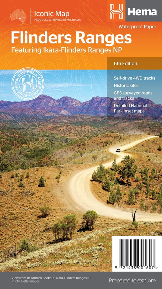
Flinders Ranges Map
This waterproof map of South Australia's Flinders Ranges includes inset national park maps and visitor information on the spectacular Flinders Ranges and Vulkathunha-Gammon Ranges, including information on the history and traditions of the Adnyamathanha people — making trip planning and navigation simple. Accompanying tourist...- $15.95
- $15.95
- Unit price
- per
-
Vendor:Hema
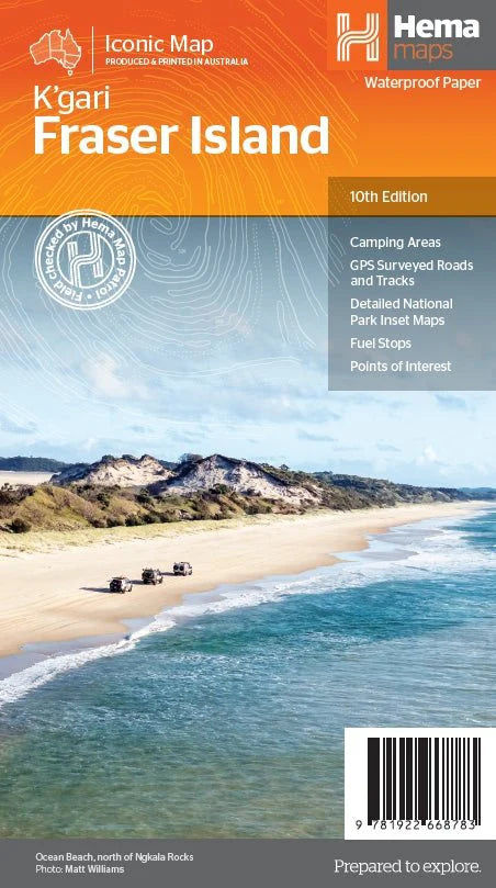
Fraser Island (K'gari) Map
K'gari (Fraser Island) is one of the most diverse 4WD destinations in Australia, with beaches, rainforests, perched lakes, sand blows, and more fitting into the world’s largest sand island. The mapping is highly detailed (1:130,000), with 4WD tracks field checked by the Hema Map Patrol,...- $15.95
- $15.95
- Unit price
- per